More Snow!

by rmajor

IMG_3375a.JPG


On the 10th of January 2011, a mere 16 days after the white Christmas, came an even heavier snowfall. I measured 7 inches of snow in my yard. The roads were bad and I knew I would be staying home for a while.


IMG_3378a.JPG

This snowfall came complete with a good crop of icicles.


IMG_3384a.JPG


IMG_3385a.JPG


IMG_3379a.JPG


IMG_3390a.JPG


IMG_3393a.JPG

I figure this guy must be from up north. I’ve noticed people who live in places that get a lot of snow are used to clearing their walkways and driveways immediately, as this guy has done. Folks from around here usually just wait and let it melt.


IMG_3406a.JPG

Snow covered woods can be so beautiful. I’m glad I made the effort to walk far enough down the road to see this.


IMG_3409a.JPG


IMG_3420a.JPG


IMG_3424a.JPG

A White Christmas!

by rmajor

IMG_3339.JPG


I’m 51 years old and I’ve lived in the Upstate of South Carolina all my life and this is the first time I can remember seeing snow on Christmas. News reports tell me there was snow on the ground in 1963, when I was 4 years old, and a dusting of snow a couple of other times, but I don’t remember any of those. This year there was a good one. Snow began falling early in the afternoon and had the ground covered by dark. More snow fell overnight for a total of 3 inches. I think I’ll remember this one.


IMG_3343.JPG


IMG_3349.JPG


IMG_3351.JPG


 Snow is a rare treat any time in these parts. I probably wouldn’t want it around all the time, but I sure do love the beauty of it when it is here.


IMG_3359.JPG


IMG_3364.JPG


IMG_3370.JPG


Roger Dowiat

by rmajor

img_0674.jpg


Roger Dowiat passed away December 23, 2009.


I met Roger at the Atlanta Astronomy Club’s annual star party, the Peach State Star Gaze. I think it was 2003 when we first met. The friendship started slowly, but grew stronger as the years went by. By 2005 I made it a point to set up near Roger so I could hang out with him.


The 2005 PSSG was particularly memorable. Roger and I were joined by our friend Bobby Thompson and the three of us had a blast. There was one night we stayed up very late. Roger’s normally jovial mood was enhanced by consumption of some “fruit juice” he brought with him. He was hoarse the next day from laughing and cutting up so much. I was later told we could be heard all over the field. For any of you who may have been kept awake by our antics, I offer no apologies. Eventually one of us mentioned that we might ought to think about calling it a night. I said, “Yeah, we’ve been up so long Leo is rising.” Bobby looked at me and asked, “You know what comes up after Leo, don’t you?” I said, “Virgo.” Bobby replied, “The sun.”


Unfortunately, I don’t have photos of that trip, as I wasn’t into photography at the time.


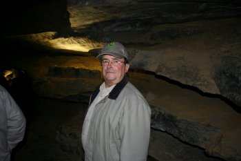
I heard Roger talk about the nice piece of property he had in Mentone, Al, and some years later I got to see it when the club held the Messier Marathon observing session there. I fell in love with the place immediately. Roger told me I would be welcome to come back there anytime. The following Spring (2008) I took him up on it. I was wanting to see Rock City, and I made plans that would include a night of camping on Roger’s property. I spent a night at Cloudland Canyon, and a couple of nights at a nearby KOA, where Roger picked me up to go tour the upper end of Lookout Mountain. We toured Ruby Falls, Rock City, Patriot Point Park, and rode the Incline Railway. We did a considerable amount of walking that day, for a couple of old guys. The picture at the top of this post is of Roger in the cavern that leads to Ruby Falls.
 

img_0735a.jpg


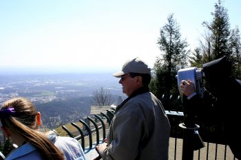
In this photo, Roger enjoys the view from the observing deck at the top of the Incline Railway.
 

img_0773a.jpg


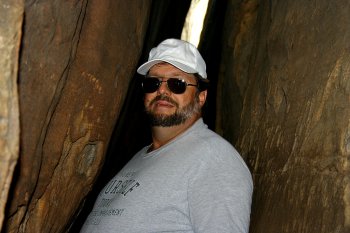
At Rock City Roger used my camera to make this picture of me navigating the Fat Man’s Squeeze.
 

img_0811a.jpg 


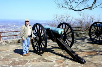
After completing our tours of Ruby Falls, The Incline Railway, and Rock City, we moved on to Patriot Point Park, site of the famous “Battle Above the Clouds.”
 

img_0839a.jpg


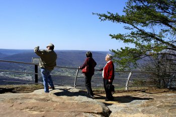
I don’t think Roger knew any strangers. When a couple of other tourists walked up, Roger immediately engaged them in conversation and began sharing some of his knowledge of the area.
 

img_0851a.jpg


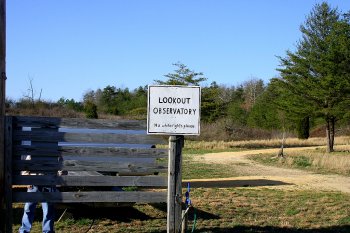
Our tour of the Chattanooga area done, we proceeded to Roger’s Lookout Observatory. I would have thought we had done enough walking for one day, but we proceeded to do some more walking around that beautiful place in the country that Roger was so rightfully proud of.
 

img_0852a.jpg


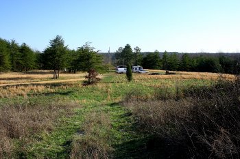
The view from the hill above Roger’s observing site.


Star Picture.JPG


It was at the Lookout Observatory that I made the first, and thus far only picture I ever made of a star. We joked about that being the astronomical building. It has a star on the front and a crescent moon on the side. To see the full moon you would have to be inside the building.


Laid-back old country boy that Roger was, I think it was appropriate that he should own a genuine outhouse. I kidded him a lot about being a redneck, but he didn’t mind. It was a title he had proudly bestowed upon himself, and he carried it with more grace and charm than any man I ever met.


Roger told me I should come back sometime and he would take me on a tour of the Little River area, but unfortunately it was never to be. Hard times soon deprived me of the means to travel. I have scoped out the Little River area on Google Earth, and I can see why Roger wanted so much to show it to me. I hope to see it someday, but I will do so just wishing I could have Roger as my personal tour guide. I will always wonder what stories he would have told and what local color he could have added.


I didn’t know it, but when I parted company with Roger the next morning after playing tourist together, it would be the last time I saw him. It would still be the better part of two years before he left this world, and we stayed in touch with occasional emails and phone calls, but we never managed to be in the same place together again. I’m glad for the times we were together, and I will always cherish the memories.


Rest in peace, Roger, and thanks for being my friend.


Station Cove Falls

by rmajor

img_3182b.jpg


Station Cove Falls is just a few miles north of Walhalla, SC, near the Oconee Station Historic Site. The Historic Site has a trail that links to the falls trail, but I decided to save that hike for another day.


img_3210b.jpg


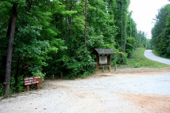
I parked at the trailhead down the road from the entrance to the Historic Site.


IMG_3207b.JPG


The bulletin board had this reassuring sign. My appropriate precautions consisted of making plenty of noise as I hiked, as several park rangers have told me that bears are usually skittish and will avoid contact with people if they hear them coming.


img_3159b.jpg


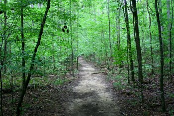
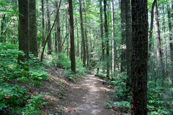
One of the reasons I chose this trail is it had been a while since I hiked, and this half mile trail was rated as easy. I did not want to push my luck with my physical condition after being off the trails for so long. The trail was indeed easy. The path was wide and well kept, and there was not much elevation change to deal with. Steps on the trail were few and far between.


img_3153b.jpg


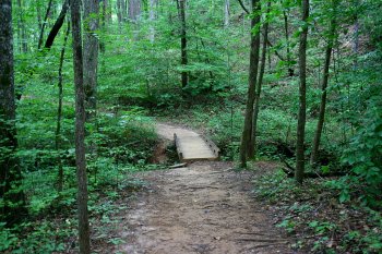
There were a few footbridges to cross over gullies and minor tributaries.


img_3168b.jpg


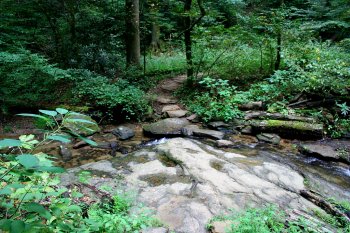
The only part of the trail that worried me was the stream crossing below the falls. The rocks were wet enough to pose a danger of being slippery. I stepped carefully and made it across without any problems.


img_3170b.jpg


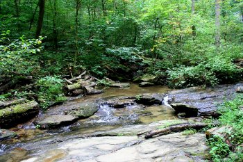
This is the view of the stream above the crossing.


img_3174b.jpg


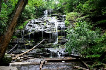
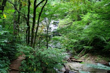
Shortly after crossing the stream I was treated to my first view of the 60 foot cascade known as Station Cove Falls. It was well worth the trip.


IMG_3195b.JPG


This is a closer view of the falls. After lingering for a while to rest and enjoy the view, I returned to my vehicle. I very much enjoyed this hike and plan to return someday.


Pigpen Falls and Licklog Falls

by rmajor

Pigpen Falls and Licklog Falls are in the northwest corner of South Carolina. The trail is accessed by driving Hwy 107 three miles north of Oconee State Park and turning left onto Village Creek Road. A right turn onto gravel Nicholson Ford Road leads to the parking area for the trail.


img_2667.jpg

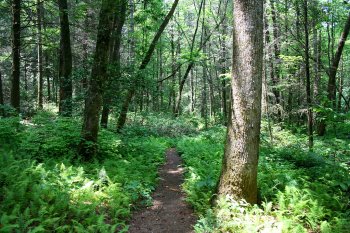
The trail begins with a .5 mile hike on the Foothills Trail.


img_2737.jpg

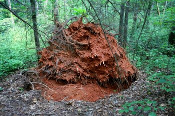
There had been some storms recently, and this tree seemed to have been a victim of it. It appeared to have been freshly uprooted. Fortunately, the tree fell away from the trail and not across it, or my hike would have ended before it got started good.


Pigpen Falls.JPG

The Foothills Trail led to the Chattooga Trail, where a left turn led almost immediately to the small cascade and pool known as Pigpen Falls. This was a very lovely and peaceful place to be, and I lingered there for a while.


img_2699.jpg

I crossed a footbridge over the creek and continued on down the trail. Lush growths of ferns such as this are pretty common in the Appalachian Mountains, and add a lot to the beauty of the hiking trails.


img_2701.jpg

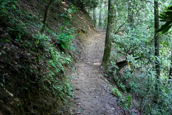
The trail got a bit narrower as I reached the Licklog Falls area, and the dropoffs got a bit steeper and deeper, but it never got bad enough for me to be really uncomfortable with it.


Rhododendron Maximum.JPG

In the area above Licklog Falls, I encountered these blossoms I was able to identify as Rhododendron Maximus.


Licklog Falls 1.JPG

This is Licklog Falls. The view was mostly obscured by trees. While there were some side paths leading down to the creek and possibly a better view, they were much too steep for me to attempt.


Licklog Falls 2.JPG

This is a wider angle view.


img_2716.jpg

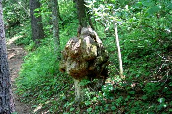
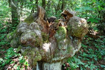
I decided to explore the trail a bit further, and came upon one of the strangest looking stumps I’ve ever seen.


img_2717.jpg

Another view of the stump. The only thing I can think of that would cause such an unusual growth would be some kind of trauma to the tree that didn’t kill it. What was left had to grow whatever way it could.


Chattooga River 1.JPG

A bit farther down the trail, a side path led to the Chattooga River. The river serves as the state line in this area. I was standing in South Carolina, the other side is Georgia.


Chattooga River 2.JPG

Another photo from the same spot, looking downstream.


At this point, I decided I had seen enough, and returned to my vehicle. The round trip was maybe 2.5 miles, and well worth doing again someday.